

Assimilation of aircraft and radar observations
With current non-hydrostatic models such as COSMO-DE with a resolution of 2.8 km, numerical forecasts of convective systems (thunderstorms) become possible.
The vertical sounding of wind, temperature and humidity needs accurate to support the right convective mode, e.g. it must have the right CAPE and vertical wind shear properties. Observations from commercial aircrafts can provide these informations, especially close to larger airports such as Munich (MUC).
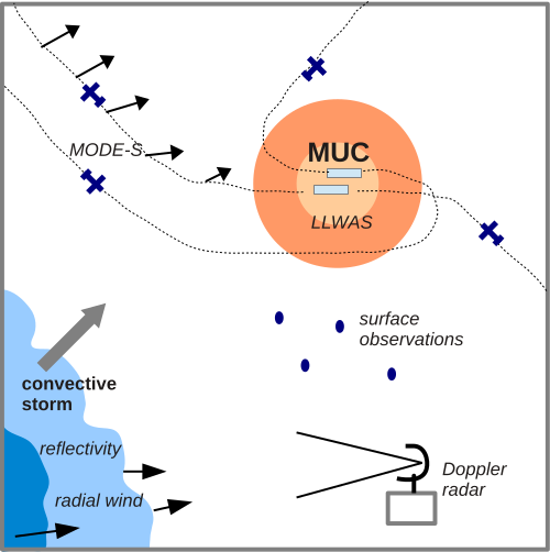
Figure 1: Observation system around Munich airport.
By 2015, only the traditional AMDAR aircraft observations have been assimilated. These come from specially equipped planes that transmit observation data of wind speed and temperature to surface relais stations.
Additionally, air traffic control data (Mode-S) can be used to derive wind observations from the triangulation of groundspeed and airspeed, and temperature observations from inverting the Mach number (de Haan 2011).
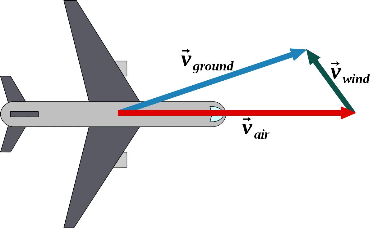
Figure 2: Triangulation of the windspeed vector from the groundspeed and airspeed vectors of a flying airplane.
The resulting data density is 15 times higher than the traditional AMDAR and has shown to be beneficial to forecasts when assimilated in COSMO-KENDA by the HErZ-study of Lange & Janjić 2015.
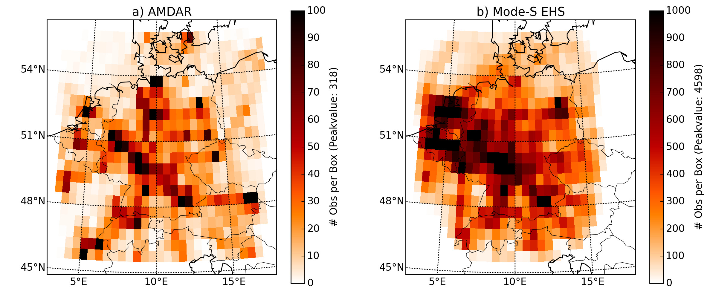
Figure 3: Data density of AMDAR (left) and higher data density of Mode-S EHS (right).
Assuming that the vertical sounding of the model is now improved, the placement and timing of convection can be corrected by assimilating Doppler Radar observations.
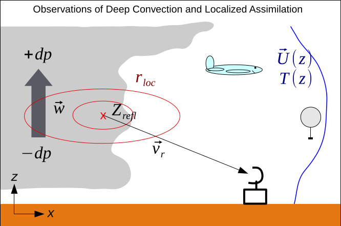
Figure 4: A thunderstorm (left) is observed with a radar in terms of reflectivity Z and radial wind velocity.
It is important to give radar observation the right spatial influence in order to create a physically coherent representation of the storm. A fully developed thunderstorm can be part of a mesoscale convective system with coldpool, updrafts and downdraft regions. This has to be kept in mind when setting up the radar assimilation in an Ensemble Kalman Filter, since the analysis is inevitably subject to sampling noise.
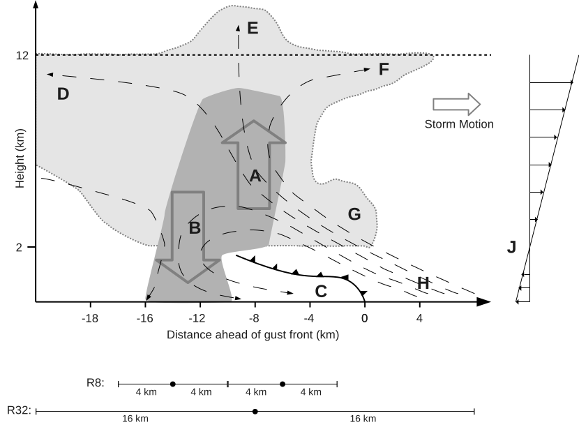
Figure 5: Conceptual representation of a thunderstorm with updraft (A), downdraft (B), coldpool (C), backsheared anvil (D), overshooting top (E), protroduting anvil (F), undeveloped cells (G), prestorm boundary layer (H) and vertical wind shear (J).
In an early HErZ-study, Lange and Craig (2014) performed experiments with a 2 km version of COSMO in an LETKF sandbox environment and found that it might not always be the best choice to force the storm analyses onto the radar observations, since dynamical imbalances can arise that are detrimental to location and intensity of the forecast convection.
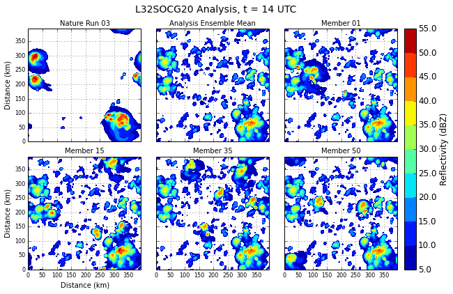
Figure 6: Experiment from Lange and Craig 2014. Observations from a nature run are assimilated with a 50-member ensemble between 14 and 17 UTC, then a 3-hour forecast is performed until 20 UTC.
Since a larger localization radius can be practically helpful for the analysis of convective storms, reducing the amount of information can further improve the spread and consistency in the ensemble data assimilation of KENDA. Superobservations can be generated that use a box-averaging at different spatial scales. This homogenizes the data distribution density and still provides the data assimilation with proper information about storm location, intensity and propagation.
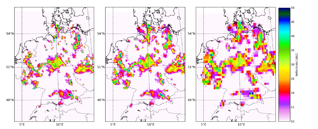
Figure 7: Superobservations of Radar reflectivity observations over Germany with an averaged horizontal resolution of 5, 10 and 20 km.